Friday, August 26, 2011

Mt. Baldy via Ski Hut Trail 8/1/09, 11/6/10, 8/13/11

The 3 T's and ECBO
Climbing Mt. Baldy never gets old; it's the only mountain I've climbed more than twice. The trailhead is a short drive from LA and it's the highest point in LA County so the view is unbeatable.

My first ascent two years ago was my first time over 10,000', long before I had any interest in peakbagging. It was also my only time taking the Devil's Backbone Trail back to Manker Flats. There's a stretch of the trail (The Devil's Backbone) that's somewhat narrow with steep drops on both sides and I could see it being scary on a windy day, but compared to the North Backbone trail, there's really nothing luciferian about it.

                                               
Pine and Dawson

Summiting Baldy for the first time
                                         
  The Devil's Backbone

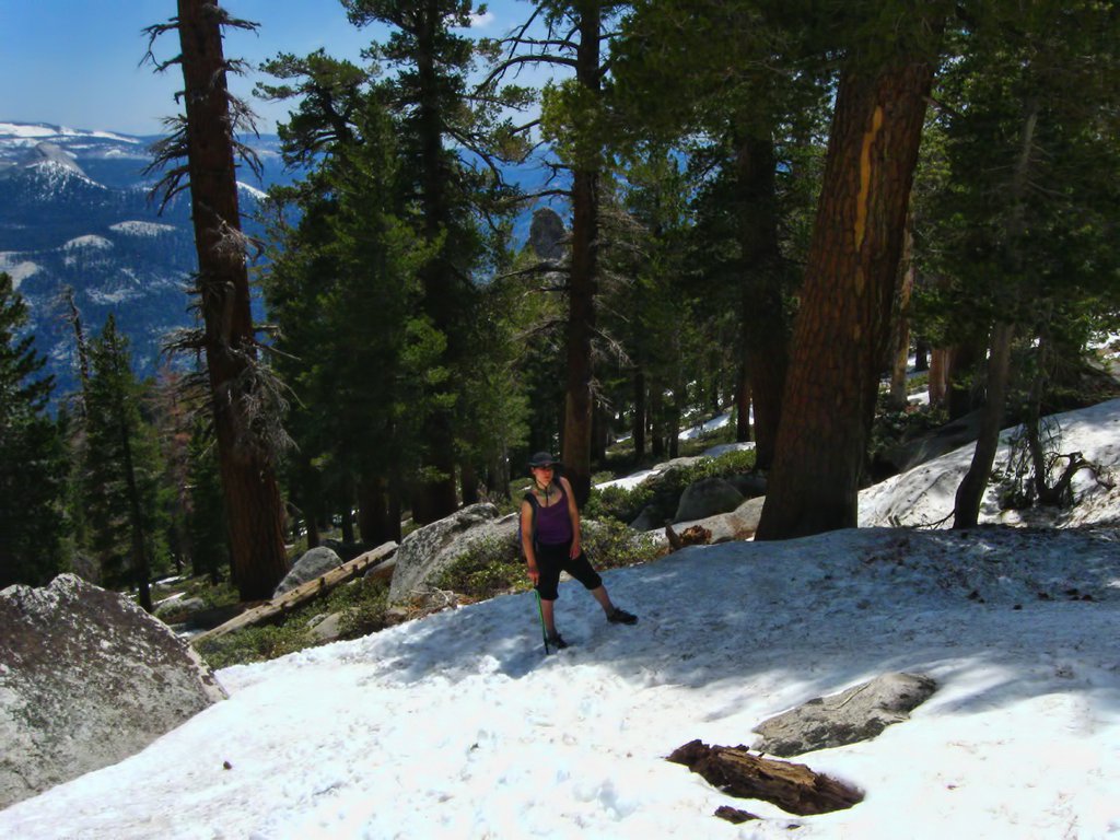
Baldy hikes can get pretty sweaty in the Summer, but you pretty much know what you're gonna get in terms of weather (other than the occasional thunder storm). It seemed like a good idea to try the climb in November to avoid the heat, but Fall weather on Baldy doesn't have the benefit of being predictable.


It's particularly important to be well prepared for a hike when you bring hikers along who trust you not to kill them, but we weren't at all prepared for the intensity of the summit that day. We dressed for the 70 degree weather at the trailhead and didn't bother to bring any layers. We probably should have turned back when we started seeing this crazy shit:


The summit was freezing and windy and we should have been wearing heavy jackets (instead of shorts and light sweatshirts). Definitely not a place you want to be if you have a fear of frostbite.

The misty descent was probably incredibly cool to walk through, but we were too busy rushing to get down to the warmth of the Baldy Lodge to notice at the time.


There's nothing easy about climbing Baldy (almost 1000' of gain per mile), but when you're thinking of it as training for Mt. Whitney, as we were on our most recent climb, you can't help but think of it as just a steep stroll. Stroll or not, there's always a way to make sure it's not the least bit boring.

Just to switch it up from the usual Ski Hut Trail hike, we ran over to West Baldy (not officially a peak), adding about a mile to the short 4.5 mile ascent.


San Gabriels from West Baldy

Baldy from West Baldy


Accuse Mt. Baldy of being boring and it'll retaliate with venomous animals. There have been a lot of rattlesnake sightings in the area lately. Watch out for these guys.


Matti took the pics.

Sunday, August 14, 2011

North Backbone Trail to Pine, Dawson, and Baldy 8/7/11

After having climbed Mt. Baldy seven times between the two of us, we thought it was time to try something new. The North Backbone Trail is one of the routes less traveled (for good reason) and it was nice to have a relatively solitary climb to one of the most popular peaks in the area. Even non-peakbaggers want to bag the highest peak in the San Gabriel Mountains.

                                     
    Mt. San Antonio from the trail


This is yet another hike that starts with a nauseating ride along the Angeles Crest Highway, except in this case, that's not even the worst part of the drive. If you want to save three miles of hiking and 2000' of elevation (believe me, on this hike, you do), you'll have to take Blue Ridge Road from the highway, which is a completely fucked up rocky dirt road that our very 2WD car did not appreciate. You're only on that road for about 8 miles, but it takes almost an hour if you don't want to drive off a cliff or completely mess up your car. Alternatively, if you have massive low-hangers or you're worried about your car, you could start from the Acorn Trailhead in Wrightwood.

We gave up after about 6.5 miles of driving on Blue Ridge Road and parked at a turnout. It added 3 miles to the hike, but the extra mileage was all flat and actually a nice way to start and end a very unflat climb. The trail to Mt. Baldy is only 4 miles each way, but this rollercoaster hike gains (and loses) about 6000' over those 8 miles. Still a good idea to start as early as possible because there are parts where you really don't want to rush yourself. Including our extra 3 miles, the hike took us around 9 hours.

Each peak starts with a descent down to a saddle before gaining some crazy elevation, so there's a total of 8 ascents on this hike: up to Point 8555 (not a peak but still requires a short climb), Pine Mountain, Dawson Peak, Mt. Baldy, then back to the trail just below Dawson, then Pine, 8555 and back up to the trailhead. If you're planning on going all the way to Baldy, the only one you can skip is Dawson, but there's really no reason to since it's an easy scramble up from the trail and only adds about 100 feet of gain.

                                                   
Ascent #1 of 8


There are some other trip reports out there for this trail, but no one seems to emphasize how dangerous it is. I'm not ashamed to acknowledge my ball-lessness, however; this trail is fucking scary. The entire route goes along the ridge, much of it with (probably deadly) drops on at least one side. The most strenuous spots going north are the climbs up to Pine and Baldy. They both gain over 1000' in under a mile and there are some tricky class 2 spots on the Pine climb, but those are the biggest challenges on the way to Baldy.

                                                   
  North Backbone Ridge

                                                 
Climbing Pine Mountain

                                        
Baldy Summit Push

There are some spots where I slowed down but at no point did I feel like I was likely to slip and fall off the ridge.

The trip back however...

Gaining over 1000' in under a mile means, of course, that it's gonna be a slippery ride coming down. There aren't any crazy drop offs coming down Baldy until right before the saddle, and even there it's only on one side. The north side of Pine is where is gets bad. It sure seemed like the steepest spots just happened to be where there were drop offs on both sides, and it's slippy as hell.

                                
Crazy drop off just north of the Baldy summit

                                                   
Taking it slow

                                  
Quickest way off the ridge (not recommended)


There was no one around for miles so no reason not to get on my ass and just scoot along the scariest parts of the trail. In some places, a hiking pole was helpful, in others, I preferred my hands. Not sure exactly where, but there was at least one spot where I just sat for a second looking at the section of the trail in front of me thinking that it was just too scary and I'd rather stay there and let the mountain lions have at me. But, of course, we continued and got back safely and well before dark.

                    
  San Bernardino and San Jacinto Mountains from Pine Mountain


Matti's pics.

Friday, August 5, 2011

San Gabriel Peak, Mt. Markham, Mt. Lowe 7/23/11

If you hike in the LA area, hopefully by now you've heard of Poodle-dog bush. It's that sage-looking plant with really pretty purple flowers growing in burn areas that you wanna just grab and take home to stick in a vase for your partner, but unless your partner's a total prickface, it's probably best to just admire them from afar. There isn't much information on it, but since the Angeles Crest Highway opened in June after the 2009 Station Fire and hikers are starting to explore the affected areas again, we don't have much choice but to start talking.

                                          
  Aaaaaahhhh!!!


After our first failed attempt to bag San Gabriel, Markham, and Lowe (we climbed Deception and Disappointment instead), Matt and I returned the following weekend armed with long pants, long sleeves, gloves, and garden shears to make our best attempt to defeat the poodle and summit these bad boys.

San Gabriel and Lowe aren't tough hikes so it was easy enough to clear the overgrown poodle blocking the trail and get to the summits unpoisoned.

There isn't an official trailhead where we started, but it's a turnout just south of Angeles Crest Highway on Mt. Wilson Rd. The trail starts out with about a mile of relatively easy switchbacks, some good views on the way and no poodle to worry about. 


San Gabriel Peak
                                
San Gabriel Mountains high country


Once you meet up with the paved road, you're just a few feet from the saddle/missile launch pad/picnic area.


The road to Disappointment is lined with poodle-dog bush (on your right):


And the trail to San Gabriel, Lowe, and Markham is on the left (also lined with poodles):


Nothing really spectacular about San Gabriel Peak.


Disappointment


Descending the newly de-poodled trail.


Just before you get back to the saddle from San Gabriel Peak, turn left to start the Lowe/Markham trail. The trail to Mt. Lowe is falling apart in places and prone to rock slides, but it's still a fairly easy hike (and now relatively clear of poodle-dog bush) and the view is much more spectacular than San Gabriel Peak. On a clear day (in the Winter), you'd get a pretty amazing view of Los Angeles from Lowe.


This is my town.

               
Occidental Peak and Mt. Wilson with Mt. Baldy in the background.


From the Lowe/Markham saddle, Markham is a short class 2 (at least) scramble through lots of poodle-dog and very loose rocks. Our hands were busy keeping us alive on this climb so there was no way to clear any poodle, and no way to avoid walking through it. We were also warned of rattlesnake activity on Markham, but didn't see any this time.


Not the hard part.
                                        

Eaton Canyon
                                            

Bear Canyon


If you're planning on doing Markham while the poodles are still at large, wear long pants and sleeves and try not to let it touch your skin. We had sticky poodle goop all over our clothes and they still smell like sage after two washes, but we haven't noticed any weird blisters from touching the clothes. I was able to get rid of the sticky black residue from the garden shears with some rubbing alcohol.


All pics by Matti.

Thursday, August 4, 2011

Clouds Rest 6/22/11

Matt and I are known for making our hiking buddies fear for their lives, or at the very least hate us and hate hiking, and there's usually at least a little bit of crying. We like adventure and danger and we tend to forget that not everyone shares that passion. We also forget that nature can be way more badass than it seems.

Don't underestimate mountains; there will always be something you didn't prepare for. Sometimes nature just wants to kill you.

Our climb to Clouds Rest was a 20-mile, 12 hour hike--the longest we've ever done. We started at Happy Isles in Yosemite Valley (at 8:30am, but I'd recommend starting much earlier), even though it is possible to shorten the hike by about five miles by taking a scenic drive on Tioga Road to the Sunrise Trailhead at Tenaya Lake. Why bother getting in the car when you can start from your campground and just walk an extra five miles?

                                    
   High Sierra Loop Trail


Judging from the research we did before the trip, few people start from Happy Isles and even fewer do it as a day hike. We figured we'd try it anyway; only 6000' elevation gain over 10.5 miles. Also our first time on the John Muir Trail.

The Half Dome cables weren't up in the morning so the trail wasn't very crowded. About 6 miles in, the Half Domers and Clouds Resters split so we didn't see many people the rest of the way. It was just us and the grouse (that repetitive grunting sound is not bear grunting).


Good luck.


When you see that sign, it's about to get crazy hard. Very steep. Lots of switchbacks (more non-bear grunting.) Once we passed the pinnacles, the biggest challenge was trying to hike through the snow without slipping, and trying not to lose the trail under the snow.


In the last half mile, the snow got deeper and we finally encountered some fellow humans who warned us about post holing.

                                
Almost time to scramble.


The final section before the summit is steep and scary as hell (class 1.5? I sure used my hands). Go slow and don't turn around or look down.


We reached the summit around 3pm. As usual, the views make every bit of the hike worth it, even though there isn't really a place that feels safe enough to just relax and take in the views. Kind of feels like you're about to fall to your death no matter where you go on the summit (not a joke, it's happened before).


Looking down on adorable little Half Dome.


   Doing my best marmot impression.


  Clark Range.


Cathedral Range


Everything went smoothly on the descent, but we were hoping to cut off a few miles at the end of the hike by taking the Mist Trail.

I don't usually give good advice, but here's some: don't take short cuts you haven't planned in advance.

The Mist Trail did indeed cut off about 2.5 miles, but we weren't prepared for the mist. Usually in the Summer, my buddy Vernal will give you a refreshing spray as you walk along the Mist Trail, but this Summer, he must be pretty pissed because that asshole was smacking the hell out of us. You need something to block your face from the "mist" (we used our hats) because breathing is important, and a raincoat is probably a good idea if you don't like wearing soaked clothes.


Just before the scary part. Sucker.


The scary part.


So Vernal Fall tried to kill us, but I've learned to hate-respect the 318 foot douchebag.


All photos by Matti.

Tuesday, August 2, 2011

The Serious Post

Hiking is dangerous. All everyday activities may have their dangers, but hiking isn't for everyone. Trails aren't always maintained and that guy you see climbing up the side of the waterfall without equipment might have the training and experience to do it safely.

If you see a sign warning you not to cross, don't cross. If a ranger tells you the trail is unsafe, take a different route.

Matt and I research our hikes before we start.  We bring the ten essentials on every hike. We never hike alone and we pay attention to warnings. We watch the clouds, we listen to our bodies, and we check the time often. We slow down or turn back when necessary. We know what to do in emergencies and how to avoid them.

In spite of all of this preparation, we've still been in dangerous situations. At times the fault is completely ours and we could have been better prepared or made better decisions, and other times we've just encountered unpredictable dangers and been lucky to avoid injury.

The hikes I do are not for everyone. They are all dangerous if you're unprepared or inexperienced. Please be fucking careful.

Alta Peak 9/25/10

Peak bagging is my new obsession. Fortunately, and unlike my other obsessions, I share this one with Matt. For now my goal is just to bag as many peaks as possible, since going for the highest peaks would be dangerous and expensive.

After I bag Mt. Whitney, the only peaks left in the US that are higher are in Alaska and Alaska has grizzlies. I can deal with black bears because they don't fuck with humans (except for about 10 times each decade, which is somehow just about the same as the brown/grizzly bear death toll per decade). After I bag the highest in North America, I'd have to climb the highest in both Americas. My next goal would be to start working on the Seven Summits so I'd head to Kilimanjaro, unless I decide that elevation is meaningless and I want to rank mountains based on their prominence, in which case the only one that beats Aconcagua is Everest and that shit really wants to kill you.

Someday (hopefully on August 31st) I'll bag my first 14er, but for now, the highest peak I've bagged is Alta Peak (11,208') in Sequoia.


The trail starts out easy. Enjoy the shade, bears, and relative flatness while you can. It won't last.


The elevation gain is only about 4000' over 6.7 miles, but 2000 of those feet are in the final two miles up to the summit.

                                         
The light blue dot is me.


There are plenty of places to hang out just below the peak, but the actual summit requires a bit of extra climbing, and the view is worth it.


A bit of extra climbing.


Pear Lake from the summit.

                                          
Great Western Divide.


This hike is highly recommended for anyone* who enjoys hanging out with bears and watching muscular shirtless men exercise. Also my favorite place to get engaged.


*Anyone who's prepared for a hike like this one. See this post.

Matti took these photos.